Thursday, May 20, 2010

An Alkaline Inland Sea in Eastern Turkey

A vast inland sea with alkaline water whose strange chemistry produces large calcium carbonate structures underwater, in a dramatic setting with snow-covered mountain peaks, 
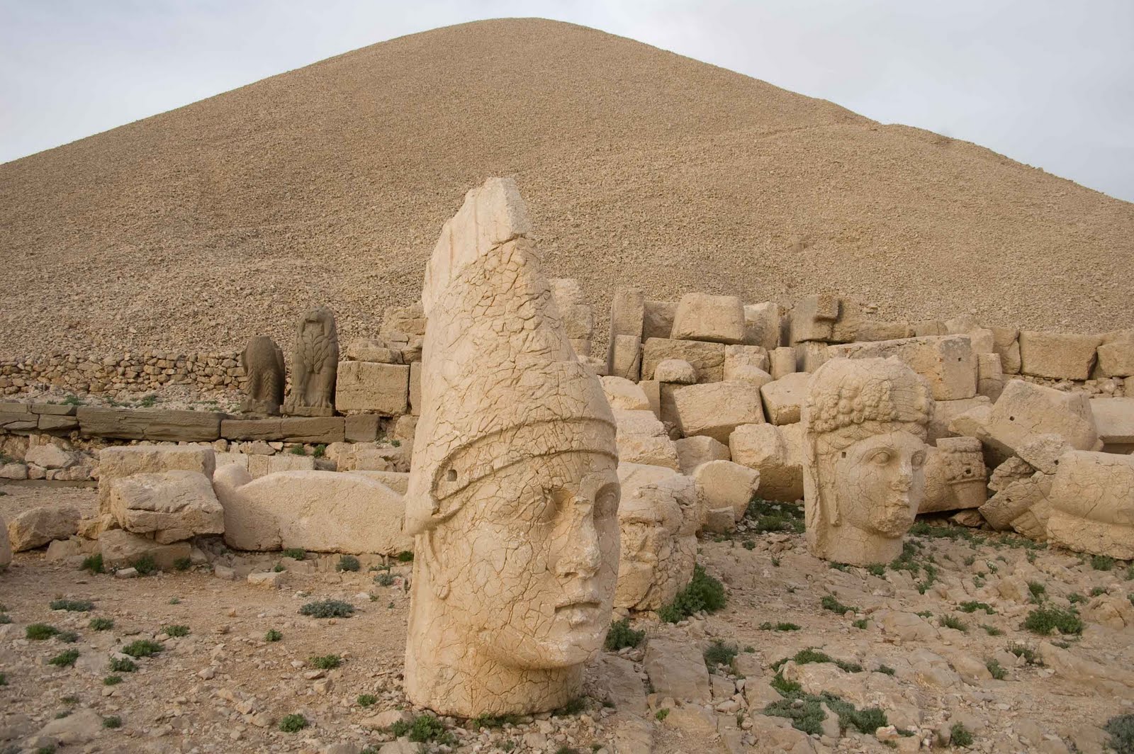
and a lake level that is thousands of feet above sea level...that sounds exactly like Mono Lake, our starting place for this 38th parallel exploration, but it also describes Lake Van, the largest lake in Turkey. This was our final stop on a 6-week trip that began in Portugal, took us across parts of Spain, Sicily, Greece, and for the last 15 days, the length of this very large country.

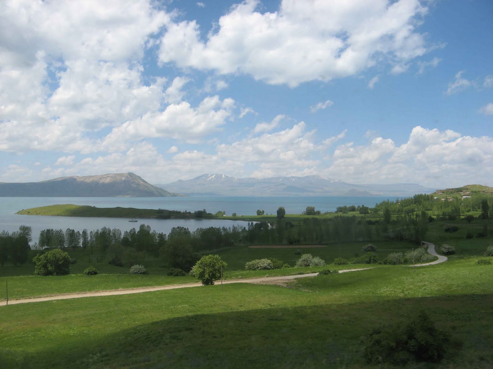
Lake Van also differs from Mono Lake in significant ways. It is much larger: a 270 mile shoreline (Mono's is about 40 miles); an average depth of 560 feet (today, Mono Lake averages about 60 feet deep) with a deepest point that is 1,480 feet! (Mono Lake is only about 150 deep at its deepest point).

Van holds a lot of water, but not much salt. It is primarily a "soda" lake, dominated by carbonates, also containing some sulfates (both key ingredients in Mono), but without our home lake's chlorides--i.e. dissolved table salt. There are fish in Lake Van, but only one species that can handle the unusual water chemistry; Mono Lake, of course, is much too salty for fish. The alkalinity of both lakes is fairly close, around pH 9.8 for Van and 10.2 for Mono. Because Van's water is less harsh, it does have the one kind of fish plus hundreds of species of plankton. Though we did not see many birds on the lake--just a few gulls--the literature says Van supports many migratory and nesting birds. Van even has calcium carbonate structures chemically related to Mono Lake's tufa formations, but Van's are out of sight in the depths, where cyanobacteria build aragonite towers up to 130 feet tall!

What a fitting place to end this segment of our around-the-world travels. We arrived by bus in the city of Van (38°29'N; 43°23'E) on the southeast shore of the lake. Adem, a medical student at the university in Van, was on our bus, and as so many other helpful Turkish people have done, he answered all our questions, was interested in our project, and when the bus deposited us in the city center, walked with us to find our hotel. Following Adem's directions, we took a mini-bus out to the lakeshore where local kids were swimming. We felt the water, which was slippery, as expected. The water here, as at Mono Lake, has been used to wash clothes. We tasted a bit from our wet fingertips (like baking soda), and waded in the water.

There is so much we could have investigated here, given enough time. We understand that climate scientists are drilling down through Van Lake's bottom mud because they can find there a half-million years of climate data from the sedimentary record. We'd like to have seen more of the lake's bird life and volcanic features nearby, but this is our last night in eastern Turkey. Tomorrow we fly to Istanbul, spend one night, then fly all the way home for a break before finishing the around-the-world exploration by crossing Asia.

Tuesday, May 18, 2010

Mt. Nemrut: Where the Gods Lay Their Heads

Today we stood knee-deep in Euphrates River water, north of Malatya in southeastern Anatolia. Only a few miles further east, archaeologists are presently uncovering a 7,000-year old city called Arslantepe. Along this river (and the Tigris, which we will visit soon) some of the oldest known human settlements occurred. This water has supported some of humanity's earliest agriculture and communities, along with the dreams and follies of kings.

On a 7,000 foot mountaintop to the south (with distant views of the Euphrates River valley as it curves east, turns back to the west, and then bends south toward Syria), a 1st century B.C. king named Antioches built a monument to Roman and Persian gods so he could place his own statue among them. The exquisitely sculpted heads were forgotten by history until they were rediscovered in 1882. Major restoration was not complete until the early 1980s. The remote summit of Nemrut Dagi National Park lies exactly on our line at 37°59'50''. This is one of Turkey's must-see treasures, though it takes considerable effort for travelers to reach the mountain. We opted for an overnight trip from Malatya that required a 3-hour shuttle to a hotel that nestles one mile below the summit. With two other tourists (from Croatia) we visited the 2 terraces and sculptures at sunset and were woken at 4 AM to return for sunrise.

The massive heads, fallen from their bodies above, have a mystical quality that immediately captivates. Fine sculptors shaped the likenesses of Apollo, Zeus, Hercules, Tyche and, of course, King Antiochos. Honey- colored stone reflects the changing light, and the setting, on a summit crowned with small stones that may cover burial chambers, is magnificent. The green valley, rock outcroppings and wildflower gardens reminded us of Tuolumne Meadows in Yosemite.

King Antiochos left a truly striking memorial behind two thousand years ago, and visitors today can share a bit of his dream of being with the gods on a mountaintop.

As for that wading experience in the Euphrates, we were actually in the Karakaya Reservoir. Turkey has built many dams in this region in recent decades...and that is our next topic to explore when we reach the Tigris River.

Monday, May 17, 2010

Fairy Chimneys of Cappadocia


Volcanic ash, hardened into rock and capped by basalt from later eruptions, then eroded by water through the ages, has created a fantasy landscape in the Cappadocia region of central Turkey. Fairy chimneys, towers, and mushroom shapes became houses and fresco painted chapels as local people carved caves into the whitish tuff--but around here everyone uses the name "tufa." In our many years of telling visitors about Mono Lake's tufa towers--the photogenic limestone formed when springwater and lakewater mix--we often heard about the "tufa" formations of Cappadocia, which actually have more in common with the Bishop tuff formed near Mono Lake by the Long Valley volcanic eruption.

Beyond that terminology story, words cannot do justice to this landscape (so we've posted a lot of photos here). The fact that people still live in many of the caves and grow gardens and apricot orchards nearby adds to the Hobbit-y feel of the place.
Visitors may stay in "cave hotels" complete with windows, terraces and satellite dishes. Huge horse stables have been carved into some of the larger rocks. Where people have moved out, birds have moved in (we watched a momma bird feed her baby chicks). Entire underground cities in multiple layers provided refuge during long ago raids. A huge, snowcapped volcano stands sentinel in the distance.

Most of our time was spent hiking, seeking the high viewpoints to look down and across the valleys. Many tourists seek similar views in the dawn balloon rides that contribute significant amounts of money to the local economy.

We met Hayriye Ciner selling her beautiful jewelry in one of our favorite parts of the valley.
Wildflowers abounded, with Turkey mullein (that exotic pest at home that is native here) and irises decorating the hillside. A fox even gave us a glimpse. Camels are a sign of the historic Silk Road connections to China in this part of Turkey.

We spent 3 days here and barely began to explore the lovely spot, but our eastward journey pulls us on toward the Euphrates River region.

Sunday, May 16, 2010

In Search of Tuz Golu (Salt Lake)


Turkey's second largest lake, the salty Tuz Golu, proved surprisingly hard to find (its south end is at 38°30', and it extends north for 50 miles). A huge white expanse hovered in the distance, but was it water or a salt flat? In May, there is water in Tuz Golu, one of the saltiest lakes in the world at 33% salinity, but it was fast evaporating with the warm temperatures. The lake appeared tantalizingly close, but proved to be a long slog through farm fields and wildflowers to the "shore" with the water itself across the Tuz Golu muck. The lake dries out almost completely in the summer, leaving behind a thick layer of salt that is commercially harvested and supplies 60% of this country's salt. In winter, the lake's deepest point is only 6 feet deep.

Though it is a huge lake, the high salinity limits life, so there were no waterbirds to be found. Land birds abounded though, with storks and harriers flying overhead and many small birds flitting in the fields. A surprised jackrabbit bounded out of the grass by our feet-- when was the last time it had seen a human visitor?

A few small islets reflected the lake waters, reminding us of Mono Lake's two islands.
The day warmed up as we hiked back, and a very friendly dog adopted us at the gas station as we cooled off with an ice cream.

Toz Golu, Turkey's great salt lake of the 38th parallel.

Tuesday, May 11, 2010

The Travertine Terraces of Pamukkale


Talking about tufa (calcium carbonate) is a constant at Mono Lake. It was a pleasure to learn that western Turkey has a spectacular feature made out of calcium carbonate--the travertine terraces of Pamukkale (37°55'). Overlooking the Lycos Valley and the Buyuk Menderes River (which twists so much it gave us the word "meander"), brilliant white terraces and aquamarine water draw tourists from around the world. The lukewarm spring water is loaded with calcium carbonate which precipitates out to form travertine when exposed to air, in a process similar to cave stalactite formation. Yet another example of how calcium, carbonate and water combine to form beautiful features around the world.

The white terraces need to dry out to really gleam, so the spring water is moved around throughout the day, providing changeable bathing experiences. One of the water management workers told us that this is a constant process throughout the year. The low-tech system includes ditches, sheets of metal and plastic bags. Pamukkale has a very interesting management challenge: dealing with thousands of bikini-clad tourists that want to frolic in the pools, while at the same time protecting the terraces. Artificial pools have been constructed along an old road route where people are allowed to swim near the natural terraces. A crew armed with brooms was cleaning dirt and algae from the lower terraces.

Adding to the scene are spectacular Roman ruins of Heiropolis above the travertine hillside (founded in the second century BC.) Multiple earthquakes forced eventual abandonment. The well-preserved theater overlooks ancient baths filled with visitors floating above broken columns!

The staff at the bookstore, Burak, Alper, and Nihan, showed us pictures of other limestone features in this part of Turkey, many in caves made beautiful by pools and limestone features.

Our day in Pamukkale was an interesting mix of wading, people-watching, and ancient ruins, punctuated by the shrill whistles of the "rangers" when people ventured too far up the terraces or neglected to take their shoes off...bare feet are required for everyone, including the cops.

The hillside is lit up at after dark, but it was the chorus from frogs in the lake below that delighted us that evening, especially when we spotted some and could watch their membranes inflate as they croaked and warbled (we'd never heard frogs sing like these).

Today we head even further east toward the volcanic tuff landscape of Cappadocia.